About the Na Pali Coast State Park
One of the most recognizable coastlines in the world.
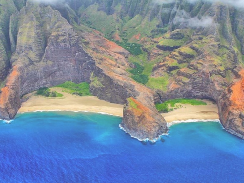
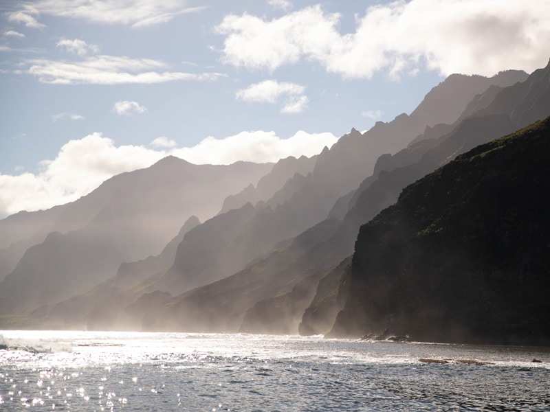
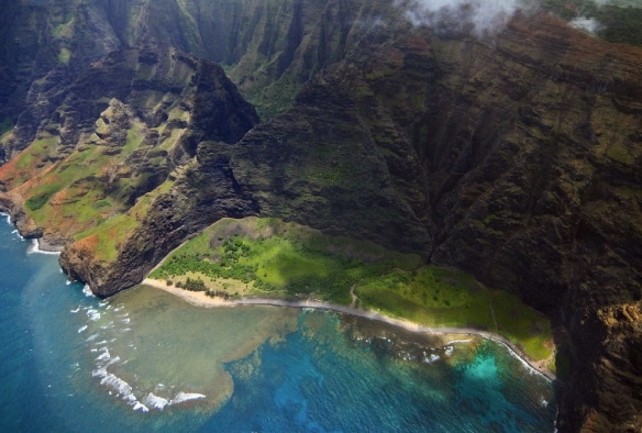
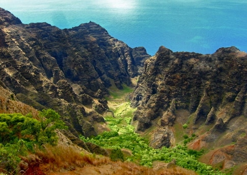
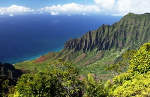
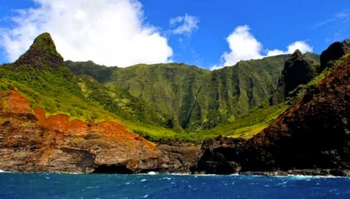
Nā Pali, literally meaning “the cliffs”, with heights soaring up to 4,000 feet, provide a rugged grandeur of deep, narrow valleys ending abruptly at the sea. Waterfalls and swift flowing streams continue to cut these narrow valleys while the sea carves cliffs at their mouths.
Spanning 17 miles along Kauai’s North Shore
The Nā Pali Coast is a sacred place defined by extraordinary natural beauty. The rugged terrain appears much as it did centuries ago when Hawaiian settlements flourished in these deep, narrow valleys, existing only on the food they could grow and the fish they could catch. Extensive stone walled terraces can still be found on the valley bottoms where Hawaiians once lived and cultivated taro.
The oldest island in the main Hawaiian island chain.
About 5 million years ago there was a volcanic eruption along the Hawaii-Emperor Volcanic chain. The eruption sparked the beginning of the Hawaiian Islands and ultimately formed Kauai island, the oldest island in the main Hawaiian island chain. Continuous volcanic activity, formed each Hawaiian island, beginning as an underwater mountain that eventually rose above the surface of the ocean.
Nā Pali was first formed entirely of lava flows
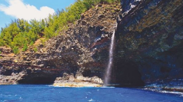
Later, water flow on the island had a major effect on its shape. Mt. Wai’ale’ale is the wettest place on earth, averaging 450 inches of rain per year. While today the water flow has changed due to irrigation measures taken by early settlers, 5 million years ago a massive amount of water was spilling onto the northwest side of the island, carving out the valleys of the Nā Pali Coast. Not only were streams cutting down from within, giant waves up to 40-ft. high continuously battered the Nā Pali Coast, and still do today. The sea caves along the Nā Pali were formed when the waves cut through the rock. And when the waves cut through faster than streams could carve, cliffs and waterfalls formed.
Polynesian navigators were the first settlers on Na Pali
The first settlers on the Nā Pali Coast were Polynesian navigators around 1200 AD. Soon after, many Tahitian migrants followed, shaping the culture of Kauai and other Hawaiian islands today. For hundreds of years, thousands of Hawaiians inhabited almost all of the valleys on NaPali Coast. Their communities were completely self-sustainable and farmed, fished, and traded amongst one another to survive. Traces of this lifestyle still remain today in the rock walls and terraces found in places along the Na Pali, like Nu`alolo Kai.
The center for trade between Hanalei, Waimea and Ni`ihau.
Trade was done via canoe and various foot trails that rose up to 4,000 feet in some valleys. Foreign influences brought diseases that decimated the Hawaiian population on the Na Pali and throughout the Hawaiian islands. As an influx of missionaries began infiltrating Kauai in the 1820’s, nudity, hula and other Hawaiian traditions were banned. Once Europeans and Westerners arrived in Hawai’i, families slowly began to move out of the area. By 1930, none of the valleys on Na Pali Coast remained inhabited by the Hawaiians.
Polihale
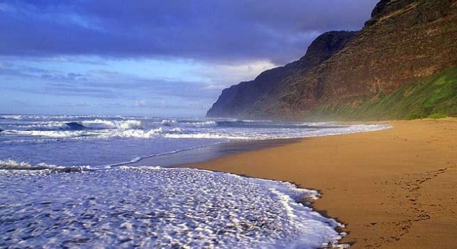
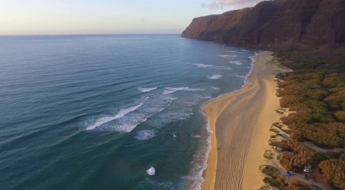
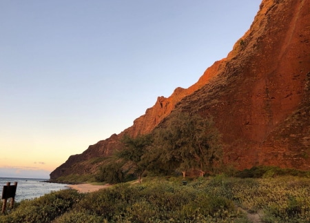
Polihale Beach is one of the longest continuous sand beaches in all of Hawaii, stretching 15 miles. The beach is also one of the widest in Hawaii, averaging 300 feet during the summer months. It is backed by sand dunes, some of them are 100 feet above sea level. Polihale was sparsely populated in ancient times. Still, several Hawaiian habitation sites and cave shelters have been discovered in the brush-filled valleys near Polihale; small groupings of grass houses bordered the foothills in a few areas, and simple stone enclosures mark sites where fishing camps were set up in the dunes centuries ago.
House of the Po
Unofficially, Polihale has been incorrectly translated in many instances as the “House of the “Po”, where Po is the Hawaiian after world. By this account, spirits are said to travel to the coastal plain adjacent to the beach, and stay in the temple, known as the heiau. From there, they would climb the cliffs to the north, jump off into the sea to get to the mythical Po.
The story further indicates that this belief was so strong that all the homes built in the vicinity of Polihale would have had no east facing doors, so that no traveling spirit could become trapped within. The foregoing story, however, offers an erroneous translation of the place name. The name “Polihale” literally translates as “House Bosom”. The root Po refers to the original night/darkness from which creation is manifested. Po in this case is the “source”; poli, is literally “bosom” or “breast”, revealing the word’s root in the concept of “source of life”
Our reservations line is available from 6:30am to 7:00pm Monday thru Friday and 6:30am to 5:00pm on Saturday and Sunday, Hawaii Time.
Miloli’i
Miloliʻi is usually translated to mean “fine twist,” after the superb olonā cords woven here. The cords were used for lashing canoes and hales together, woven into nets and any purpose needing a long-lasting, extremely strong cord. Another possible translation is “small swirling,” named after the offshore currents. Miloliʻi has a narrow valley with steep slopes with the shore completely lined by reef, still rich fishing ground. There was an extensive irrigation system, and the remains of many structures, from taro ponds (Lo’i Kalo) to Hale terraces, can still be found.
The valley is cooled by two breezes: Pāhili-kai, “forceful winds from the sea,” and Hā-loa, “long hard breath,” which blew from the windward side of Ke-ana-o-Kū, “cave of Kū,” whose whereabouts is still unknown. Kaʻa-hole, “to peel by rolling” is a small valley on the northern end of the seashore. On the south is the side valley of Ka-uhao, “the scooping,” where many remanence of temporary fishing shelters and shrines still remain. The valley was named after Kauhao, laughter of Kapalama and Honouliuli, who lived during the reign of Ahukinialaʻa. She married Ke-ahua, a chief of the Puna kingdom, and had two children, Ka-uʻi-lani and Lepe-a-moa. The point at the mouth of the valley of Ka’auhau, “tax,” is named Lepeamoa. It is said she was born in the form of an egg. She could take on the form of many kinds of birds, as well as that of a beautiful woman, but her favorite shape was that of a hen.
Nu`alolo
The last of Nu’alolo’s Hawaiian residents vacated the valley in the early 20th century, leaving behind a complex series of rock walls and platforms, evidence of a rich and orderly life. Archaeological evidence suggests that Nu‘alolo was continuously occupied for 800 years, from the 12th through the 20th centuries. Remote and isolated, the narrow coastal flat of Nu’alolo Kai is surrounded by towering, amphitheater-shaped cliffs on all but it’s ocean side. Once an abundant fishing village, now only traces of it remain. A rope ladder, Ke-alahaka-o-Nu‘alolo, used to hang at Alapi’i point, connecting Nu’alolo Kai with the farming settlement in Nu’alolo ‘Aina around the corner. Multiple, elaborate terraces of Nu’alolo ‘Aina are reminders of the Lo’is that were abundant here.
Ke ahi lele o Kamaile, “soaring fire of Kamaile” refers to the fireworks cliff, Ka-maile, a round hill above the concave cliffs. Firebrands, in a display called ʻōahi, were thrown like javelins from the top of the cliff and soared in the air, spewing out embers until the sticks fell into the sea a mile or two offshore. The mountain is named after Kamaile, a chiefess of Nu’alolo, who was loved by Kūponoaloha. But kamaile married a stranger from Tahiti, ʻŌʻili-kū-ka-heana, who brought the first ʻawa, a narcotic plant with him. Kamaile became addicted to the plant and eventually her skin became scaly and her husband left her. She uprooted all of the ʻawa plants and threw them away. Kūponoaloha, to prove his continuing love, caught a firebrand and scarred himself with it. Realizing the depth of his feelings for her, Kamaile married him.
Awa`awapuhi
Awa’awapuhi is a narrow, steep-sided valley extending from the sea to its headwaters on the south end of Kahuama’a Flat in the mountains. There are remains of taro terraces ranging from 2 – 4 feet high and many house sites on both sides of the stream and burial caves on the western cliffs.The name Awa’awapuhi, means “eel valley” which refers to a puhi (freshwater eel) named Kuna who, searching for a new home on Kauai, swam along the cliffs.
He found the mountains interesting, so he slithered up the cliffs to explore. The eel gouged out the valley on his way up, which gives the valley its shape today. The legend states it was a cold day and the eel became sluggish and fell asleep on his way up. Later a group of native Hawaiians from Kalalau on their way to Waimea, came upon this very large eel lying stiff and straight beside the trail. They prodded and poked it with no reaction, so they decided it was dead and it would make them a fine meal. They tried to curl it up so it would fit into a cooking pit, but they could not rearrange the eel in any way. Instead they lined the eel on both sides with rocks, piled firewood on top, and set it on fire. This woke the eel and Kuna ate all the people before returning to the sea. The rocks are still there, a parallel line of stones that marks the length of the eel, and the area was named Ka-Lua-puhi, “eel pit”.
The Open Ceiling Cave
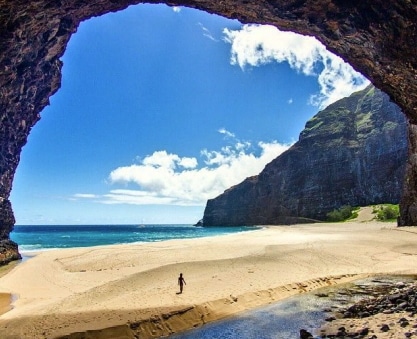
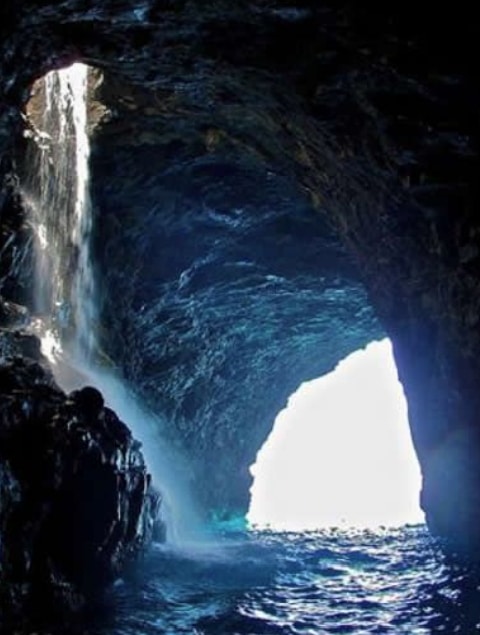
The Open Ceiling Cave, also known as Pukalani, “hole into the heavens,” was once a closed hollow lava tube. It was created naturally when the ceiling of a massive cave collapsed in on itself due to erosion from the powerful ocean waves. What remains is an impressive, massive skylight in the roof. Early Hawaiians used to believe this cave was the home of a shark god, but now is one of the most visited sites in Hawaii.
The fallen portion of the ceiling can be found at the center of the pool and be intimately observed. The cave opening is much smaller when compared to its magnitude. In the summer, sunbeams shoot through the entrance of the Open Ceiling Cave, penetrating through the crystal-clear water, and reflecting off of the white, sandy bottom. The result is an amazing, heavenly-blue color that glows through the surface of the water.
Honopū
Honopū or “conch bay” is so named because when the winds blow, it makes a sound that is similar to the conch shell when northerly winds blow into the arch and was said to have produced excellent olonā cordage in the olden days. The southern beach is Honopū-wai-kanaka, “Honopū’s water for mankind.” The waterfall that falls onto the sand beside the arch is Ka-pona, “variegated colors.” The wind is Wai-kuʻau-hoe, “paddle-handle water.”
The northern beach is Honopū-wai-akua, “Honopū’s water for the gods.” The uplands of Honopū are dominated by Ka-ina-manu, “sound of birds in the distance,” a 4,000 ft peak at the top of Kala-wao, “to proclaim through the wilderness,” the western valley and stream. It joins Kapaka stream to form Honopū river.
Honopū is a spiritual place of Heiau’s and burial grounds, and the source of many Hawaiian legends and myths. Burial sites for the local chiefs were located on the surrounding cliffs. It was believed that once a chief died, his bones held a supernatural power, “Mana,” and if found by others they could be used against the chief’s tribe. When chiefs died, their bones were collected and taken to the cliffs, and the warrior who transported the bones had to die in order to ensure the secrecy of the location of the bones. Honopū Valley is also known as “the valley of the lost tribe” as it was the home of the last Menehune.
Kalalau Valley
The Kalalau Trail is an 11 mile ancient Hawaiian footpath, the main access to the Na Pali coast today as it has been for centuries. It is estimated that as many as 5,000 Hawaiians lived in Kalalau Valley when Capt. Cook arrived on Kauai in 1778. Bowl-shaped within sheer walls of rainforest green, it’s 3 miles back and 3 miles across. The valley’s great west wall ends toward the sea in cascading cathedrals of stone, with lava dikes upthrusting like their namesake, together forming three towering, knife-edged pyramids, known as the Three Guardsmen.
Pohakuao Falls & Sea Arch
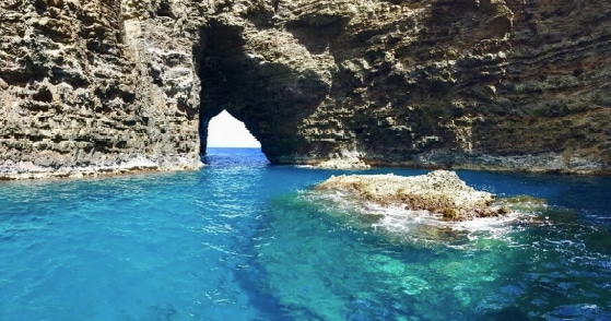
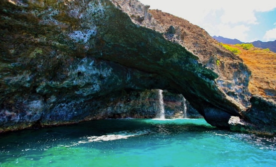
This beautiful sea arch is accompanied by the Pōhakuao falls and during extremely calm sea conditions smaller vessels may travel through the arch. This area is named for the rock Pōhaku-kū-manō, “rock resembling a shark,” in the cave Ke-ao-mau, “snagged cloud.” The rock is sixty to seventy feet long and resembles a shark with it’s head by the waterfall and it’s tail toward the sea. It is said the cave, in days before the stone appeared, was a favorite place for Koʻamanō, the guardian shark of the seacoast.
Hanakoa
As a large part of the Bali Hai ridge the valley is comprised of two incredible lava dyke ridges protruding up each side of this lush, tropical rain forest valley. Hanakoa Falls is a tiered waterfall nestled in one of the cathedral-like wrinkles in the mountains backing the valley at mile 6 of the Kalalau Trail. The falls are estimated at a total height of 1,400 feet with the tallest single drop at 440 feet.
Hanakoa, “bay of warriors” or bay of koa trees” has a good deal of gently sloping land on either of it’s main stream, as well as in the Waiahuakua drainage basin. Hanakoa had extensive remains of Hale sites and Lo’i terraces extending more than half a mile inland, but many of these were obliterated when coffee began to be commercially grown here.
Waiʻahuʻakua Valley Double-Door Sea Cave
Waiʻahuʻakua, “double door,” is horseshoe shaped and stretches over 1,155 ft. It is the second longest sea cave in the world. It is also known as the Sacred Water Cave and as the Double Door cave – as it has both an entrance and an exit. A fissure in the roof of the volcanic rock allows a waterfall to drop into the amazing cavern.
The Double Door Cave is believed to be more than a million years old. It was created from volcanic eruptions and sculpted by crashing waves that carved its arches and ridges. What you see above water is only a fraction of its beauty. There’s a whole world underneath the surface that’s teeming with life.
Waiwaipuhi Sea Cave
Waiwaipuhi Sea Cave is nick-named the Pirates Cave, but literally translates to “great blowhole,” because in the winter months, the crashing surf turns the cave into a powerful blowhole that spews water straight back out to the sea. The rock formation features a waterfall at its large entrance and is 951 ft in length

